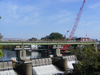
While reading many, many sites and related matter from the ’38 Hurricane,
One interesting observation was that in Woonsocket, the windows were encrusted
With sea salt.
Being a good 50 miles from the open ocean, I have no doubt the winds exceeded
120 mph up here as reported in some articles.
I dread even thinking what the effects of a similar storm would be in the “modern”
World. Just repairs to the electrical distribution infrastructure would certainly be
On the order of months not to mention structural damage. With communications,
Computers, television and our primary source of energy
all connected to utility poles, life as we know it would be interrupted
For a considerable period of time.
News, notes, quotes and errata from the Greater Woonsocket, Rhode Island area. Woonsocket is on the northern border of Rhode Island/Massachusetts and bounded by Blackstone and Bellingham on the Massachusetts side and North Smithfield, Lincoln and Cumberland on the Rhode Island side. The city of about 40,000 is 35 miles SW of Boston, 25 miles S of Worcester and about 15 miles N of Providence.
Wednesday, September 29, 2010
Wednesday, September 22, 2010
Saturday, September 11, 2010
...as I wramble about Woonsocket street names
Park Avenue: without a park;
Willow Street: yet to have seen a willow;
South Main Street: takes you to the North Northwest;
Providence Street: Providence is south of Woonsocket, the street leads you east and west;
Market Square: without a market;
Blackstone Street: does not bring one to Blackstone;
Mt. St. Charles Ave: The Mount is on Logee St
Saturday, September 4, 2010
Hurricane Earl Post Mortem
Hurricane Earl passed by New England with just over a half inch of rain here in Woonsocket. Cape Cod bore the brunt of the storm with upwards of 5 inches of rain around Hyannis, scattered power outtages and surely some beach erosion, rips and rough surf. Earl was a very large Hurricane in girth and that may have helped his demise. Off the SE coast as a Major Cat 4 Hurricane, his wide circulation began to feed in some dry air in the Carolinas helping to weaken the storm. There are many other reasons, but we are all lucky in the Northeast to have dodged a bullet. A Cat 4 making landfall would have caused perhaps damage unseen since the Hurricane of 1938. Everyone who checked their emergency kit, freshened up supplies and reviewed their emergency plans, kudos to you !!! Yes, not really needed this time, but there will be a "next" and it could be serious so never ignore the forecast, yes, things do change as Mother Nature is wont to do, but it is always wise to be prepared !!!
Subscribe to:
Comments (Atom)


